
Intro to LAMA
Loading (or Returning to) a Saved Layout
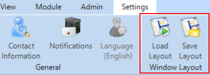
LAMA’s interface is very customizable. Many users choose to customize a layout and save it, using “ Save Layout” on the Settings tab.
If you accidentally change something in your LAMA layout and aren’t sure what you did or how to undo it, going to “ Load Layout” and choosing one of the predefined (or user-saved) layouts will most likely restore your settings to something familiar.
 Viewing Modules
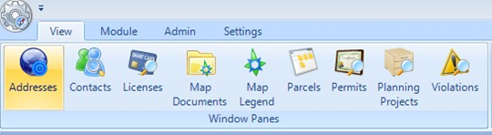
LAMA has different “modules” for different uses. For instance, code enforcement cases are in the Violations module, permit applications go into the Permits module, city/county planning and engineering projects cases go into Planning Projects, etc.
You can switch module views more than one way: from the View ribbon on top,
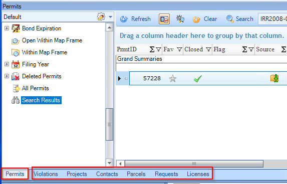
Or on tabs below the Query Tree and Grid.
Seeing All Associations with a Specific Address
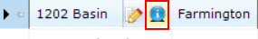
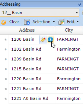
Search an address in the Addressing pane and hover over the address. When your mouse is over the address, a blue circle with the letter “i" in it will appear, and double-clicking on that will show you all associated data. Double-clicking on any permit, project, violation, etc., will open the associated Permit, Project, or Violation form.
If you don’t know the exact address number, you can use an underscore as a wildcard. For instance, to search for everything on the 1200 block of Basin Rd, you can enter 12__ Basin in the text box.
Address Search Pane
Searching for an Intersection
Another way to search for a block-range or an intersection is to click on the icon that looks like a satellite dish on the Map toolbar.

This opens up options of searching by intersection, by a range of block numbers, or a mouse-clicked location on the map.
The tool to select a parcel on the map is a small arrow next to the icon of a small map.

Grid Data
The Grid pane can be used to display data about parcels selected on the map, addresses selected in the Addressing pane, Queries defined in the Query tree, or custom-searches from the Search menu item above the grid. Whichever module is currently selected will determine the results you’ll see.
Query Tree
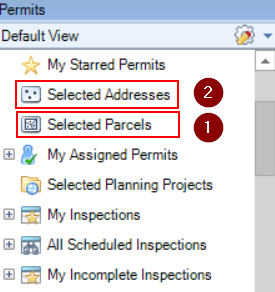
Select a Parcel from the map. Select the query, Selected Parcels, from the Query Tree, and see all violations associated with that parcel populate in the grid/table area. Select an Address in the Addressing Window. Select the query, Selected Addresses, from the Query Tree, and see all violations associated with that address populate the grid/table. Note: This applies to any module.
Filtering the Grid
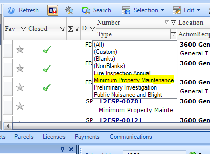
Every field on the grid has a small filter icon next to it – you can use that to limit the results, e.g., to show only “Minimum Property Maintenance” items, not “Fire Inspection Annual” items.
Grid Options
Other ways to control how much or little you can see in the grid, and also how to export grid results to a spreadsheet can be found in the Grid Options menu item, as shown below.
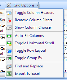
- “Show Column Chooser” is a useful way to add or remove the fields you’re interested in.
- “Toggle Row Layout” controls whether each permit/violation/project case’s data is grouped into two rows, or one. Two rows make the data easier to view on a screen, but for outputting to a spreadsheet, the grid should be toggled to one row of data per record:

Viewing Specific Item information and Documents
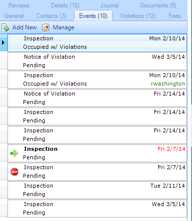
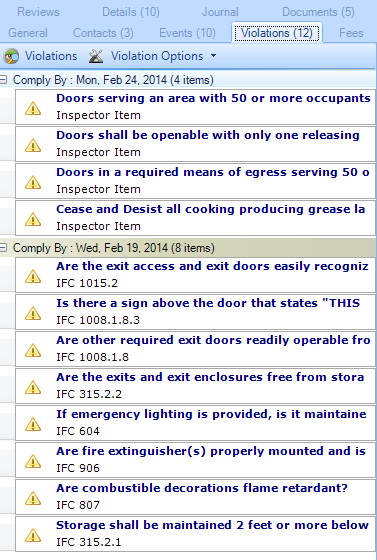
Selecting a row from the grid will open that Violation (or permit, project, license, etc.) in the Violation Form. Different tabs on the form can show you things like:
- The sequence of events and their status;
- Violations identified by the inspector;
- Documents associated with the case;
